The more one knows about a landscape, the more interesting it becomes to explore. Obviously only the subject matter specialist can really read the palimpsestic canvas that a landscape is , but it only takes some basic bits of knowledge to realize there is something to be seen in the first place.
It takes a huge wow factor (and even then…) for a landscape to breach the defenses of your automatic pilot unaided. I would argue that most of The Netherlands, and Brabant is no exception, lacks that. But even some basic knowledge can make for a mindset that is attuned enough to the environment to start seeing the less overwhelming but no less satisfying the country has to offer.
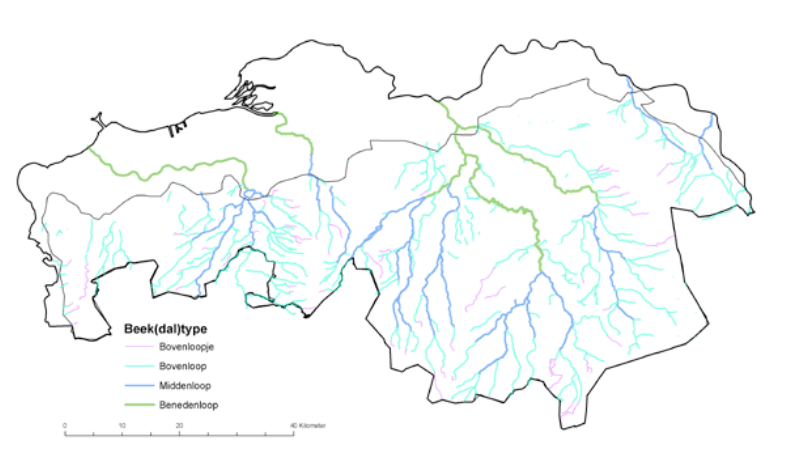
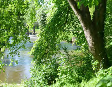
Thus it helps to know that North Brabant is a part of The Netherlands that is above sea level, most of the province belonging to a sandy plateau sloping down from the Ardennes. It is a landscape of brook valleys, all tributaries of the Meuse, the river that forms the northern border of the province. Two main brook systems are the watersheds of the Dieze-Dommel and the Donge that divide the province into West and East. The slope of the plateau – for the Dommel from its Belgian source to its confluence with the Meuse 75 meters – is steep enough for the river system to be good for water milling. And the geological history of the plateau has created a variety of riverine habitats much more diverse than that of similar catchment areas like that of the Drentsche Aa up North.
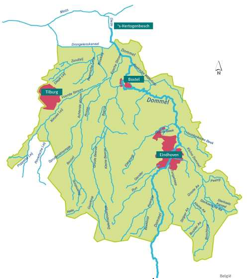
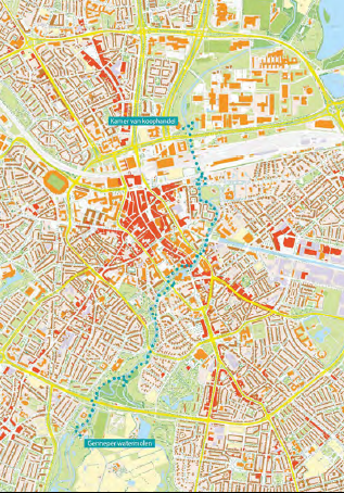
This variety of different kinds of brook valley landscapes dictated settlement patterns, and the possibilities for farming and affiliated exploitation. The Dommel and its tributaries in and near Eindhoven have been a huge determinant in the development of the city and the region. The Dommel is – and very visibly so – the artery of the city. Future posts will explore the geological and urban history of the region in more depth. Here I focus on this (small) river’s current status as a green lung traversing the city from South to North, connecting two of its three so-called green wedges, and making for a great walking and running destination. Over decades the river banks have grown into a remarkable linear park that is testimony to a consistent vision about the need for green space but in its remaining discontinuities also to a lack of awareness about the importance of uninterrupted connectivity. How to go about exploring the many possibilities this green lung offers?
One can explore looking for very different things. Nobody can decide for you what to focus on. The below looks for my personal fancy: a max of off-road, muddy trail, and natural variety (with the occasional architectural, cultural etc. highlight thrown in for diversity’s sake). I mentioned the Dommel valley is a great running destination didn’t I? The focus I use in this post is based on my exploration of the valley as a trail runner. In case you wonder about exploration as a purpose for a run (isn’t running for health, training, in prep for races?): running and walking are quite similar, so similar that I self define as a pedestrian rather than runner or walker (for more background: see my post on pedestrianism and purpose).
However that may be, that the particular Dommel valley exploration described here has a specific focus means that it is to be read as an illustration, not a guidebook. The whole point of exploration is that you do it yourself. The fun of it is inhabiting the right mindset, and making your own discoveries. It requires venturing out and regularly trying something new. I can guarantee that it takes many exploratory traverses of a landscape before you know it so well that it doesn’t hold any secrets no more. Even if the particular perspective underlying the below observations and suggestions matches yours, consider it only a starting point for your own explorations. And let me know what alternatives you come up with!
My entry point for any pedestrian exploration is VisitBrabant’s hiking route network. To make the most of this post: open the link (it opens in a separate tab) and click on the hiking network and keep that browser tab open. Their routes are designed by locals knowing the terrain better than anyone else. Whatever their route from one network node to another, there is a good reason for its trajectory meaning that following it you can’t really not end up having a good outing.
Next request: open the result of my Dommel valley exploration and again keep the tab open. What follows compares segments of that what the hiking route network offers and what I ended up with after running that route and subsequently exploring alternatives suggested by the map or hit upon while on my feet. Having the tabs open to versions of both allows you to zoom in and out to any level of detail and overview you desire or require, and makes following my explanations/descriptions below easier.
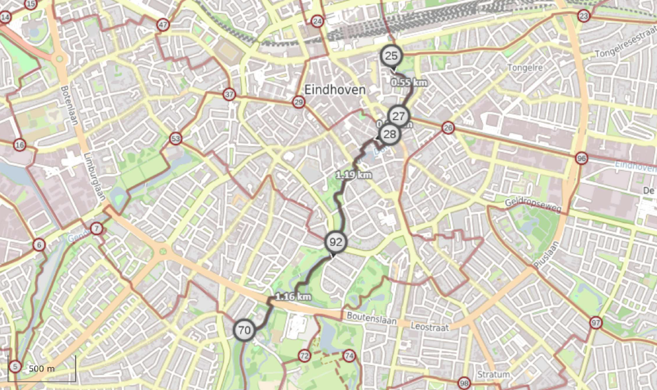
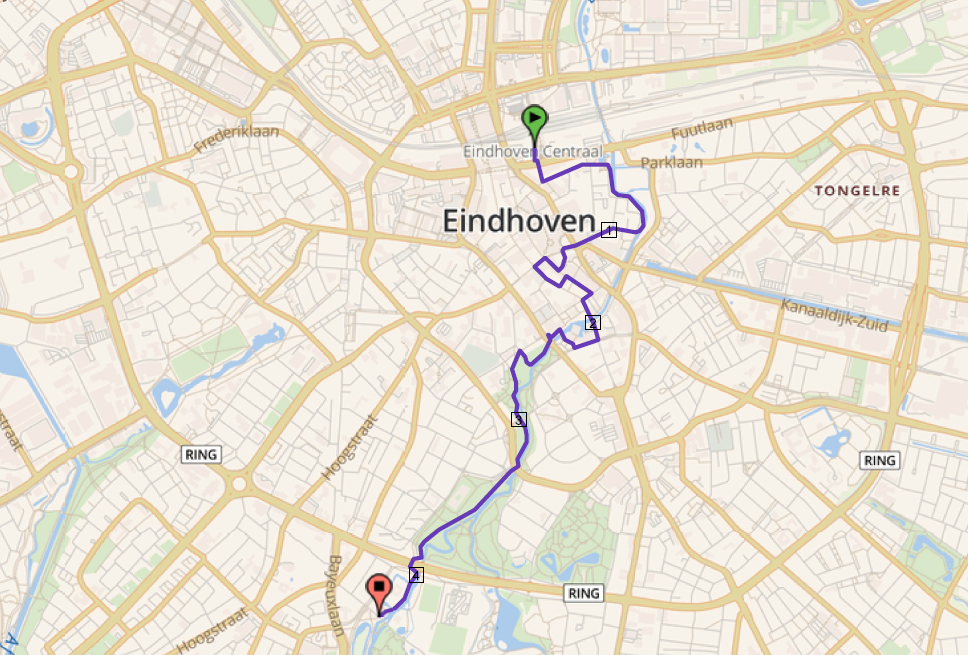
My route starts and ends at Eindhoven railway station, is designed as a figure of eight, and is doable as one day exploratory ultra (trail) run, or a faster ‘exercise run, or two or more days walking. All up to those who would want to see for themselves, but – I cannot emphasize this enough – my point is not so an invitation to literally follow in my footsteps, as it is to walk you through my process of creating it and inviting you to metaphorically do so.
Various sites of interest along the route have ‘opening’ times, etc. so in case any stir your interest: keep those in mind. In case you’re one of those loonies interested in doing it as an ultra, please be my guest – or in proper Denglish: go your gang – my personal preference would be to do the more urban Southern loop first.
The Dommel valley – with its urban and rural diversity – is a fascinating example of the uniquely rural metropolis of Zandstad. Embrace and celebrate this diversity and the fusions that it spawns. Its urban and rural corners feel both familiar and like one of their own kind. A bit liked this beautiful example of musicians from different traditions meeting and ending up with just that kind of beat:
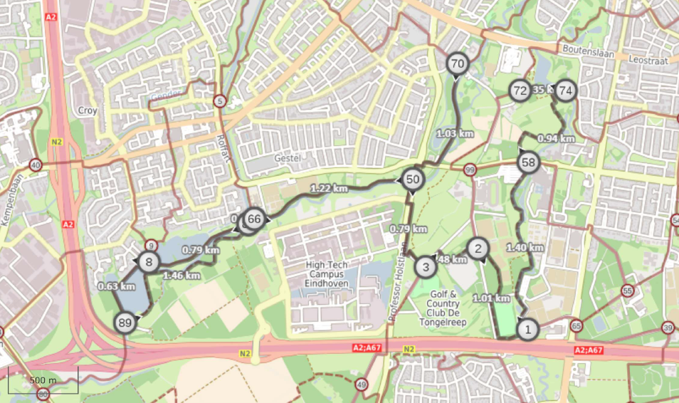
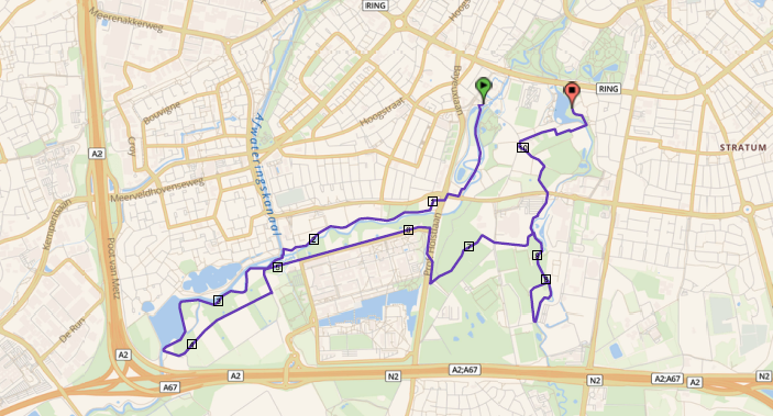
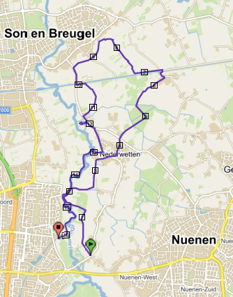
The basic premise in designing this routes was to follow both banks of the Dommel, but with as little backtracking along the same trail as possible, building in trails along tributaries and through characteristic urban and rural landscapes – without making the claim that this is a Dommel route silly – and all staying within the limits of what makes for a feasible one day running exploration. Below, the Southern and Northern loops of my figure of eight are each divided into three parts.
As one would expect, the first Southern part of VisitBrabant and my route going through the inner city resemble each other quite closely (to zoom in for more detail: go to the respective interactive maps that you have opened in separate browser tabs):
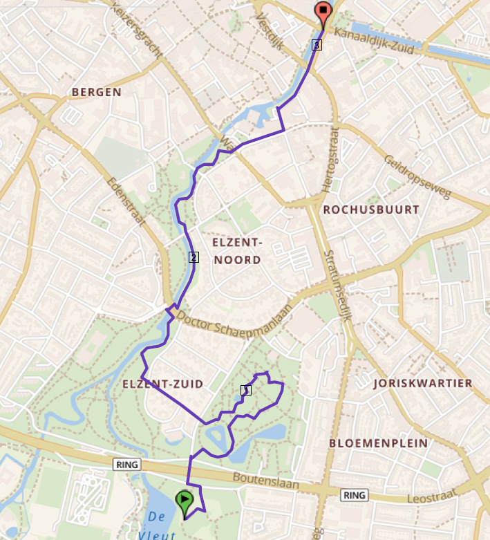
Obviously, the city centre contains a lot of interesting urban heritage. Both the VisitBrabant route and my own includes some of it, but, as the focus of this exercise is on green, way less than when the focus of this exercise would have been on maximum diverity. VisitBrabant sticks to the river, my route makes a short diversion into the city centre. As limited as it is, this little loop takes you along some of Eindhoven’s most notable urban sights: Domusdela, which includes the oldest building in town and the Paters ‘Jesus daredevil’ church, and won the 2020 BNA (Association of Dutch architectural firms) audience award , the Karel Vermeeren city garden, with its old trees and eye catching work or art, the neo-gothic Saint Catherine’s church – spend time inside if you can – the stacked terraced Medina flats, the country’s longest pub street, and the delightful Rietveld bus stop, next to what must be one of the most singularly ugly town halls plus square imaginable – make sure to have a good look at it, it takes a special talent to build something without any redeeming qualities; all the more interesting to see if and how the grandiose plans for the high rise future of this part of town will manage to transform it.
The VisitBrabant route switches river bank several times, mine stays on the West. The reason is simple: within VisitBrabant’s network structure of routes, it make sense to follow the footpaths along the river once, and choose the nicest, most interesting route, whatever side of the river that happens to be on. Thus, if you want the nicest walk along the river: follow their route. Mine, not bound by the requirement to link up at network junctions, chooses to stay on the West side for the way out, and then return on the East side. Thus, if you look for max off-road: follow mine. And whatever you do, notice how lucky you are to have such a beautiful huge park, right in the middle of your city.
One resource to make use of when you walk or run the city part of the Dommel, is an online available (free download) guide describing 48 interesting (groups of) trees between the Chambers of Commerce building at the entrance of the TU/E campus and the Genneper Watermill. Tom van Duuren of the AtelierNL audio walks collaborated with the municipality in producing this beautiful book. Unfortunately it is (still? any volunteer translators out there…?) only available in Dutch, but its detailed maps and photos make it accessible enough for all you tree lovers, to be able to make good use of it.
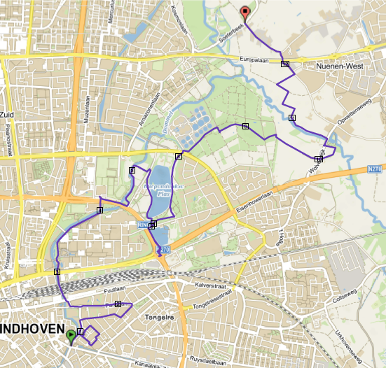
On to the second Southern part of both routes:
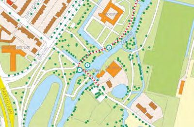
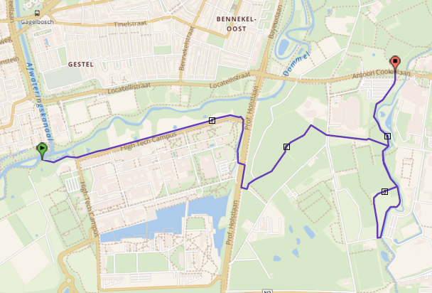
From the Genneper water mill to the entrance of the Klotputten, both routes are the same. Then VisitBrabant sticks to the Western bank of the Dommel, passing the recreational Hanevoet lake (named after the architecturally disctinctive Hanevoet neighbourhood visible across the water), and circling the Klotputten sludge trap, returning along the Dommel through an area the name of which recalls its history of peat (‘klot’) extraction. My route is all inside the Klotputten, making the most of its muddy trails.
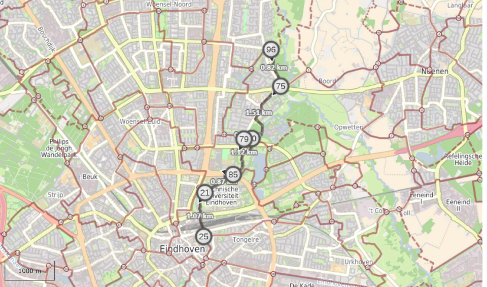
What follows next – see the below more detailed sliding maps (or zoom in even further using the interactive maps in your other browser tabs) – shows even better what choices a focus on unpaved trails results in. Exiting the Klotputten without crossing the Dommel gets one to a back entrance of the high tech campus and a trail along its moat, followed by an elephant trail until close to the main entrance. The campus is open except during the weekend, and when open I would suggest to use the back entrance, traverse the campus, and exit through its main entrance. That makes for less unpaved (yes I self-contradictory argue for diversity over mud here), but the central water corridor and the buildings lining it are an urban joy to behold. Both our trails then aim for the gem of a trail along the Tongelreep (a Dommel tributary), but my version, with some backtracking is near all unpaved.
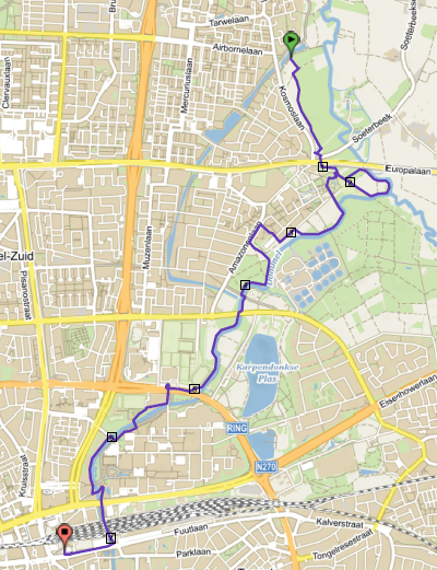
On to the third Southern part, taking us back to close to where we started. Both routes traverse the Genneper parken and the Stadswandelpark, well-known recreational hotspots. My route then cuts back to the Dommel, making the most of that green lung, returning along its Eastern bank. VisitBrabant makes an urban loop. I won’t go into detail here, but one highlight this version takes in is Garden city de Burgh, better known as het witte dorp (the white village) – read up about it in Eindhoven Architecture City. It crosses three of the radials connecting the city centre/old Eindhoven to surrounding villages, roads that made for a ribbon development settlement pattern still recognizable in the character if their buildings. My route is not totally deprived of urban interest either. It takes in some of the upmarket 1930s Elzent neighborhood and offers a close look at the architecturally striking Van Abbe museum (make sure to visit if you haven’t yet!).

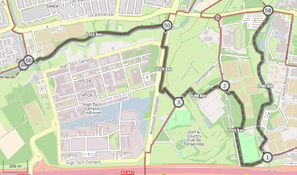
Let’s turn North now. For this Northern loop both routes (mostly) stay to the East of the Dommel on the way out, and return (mostly on the West. Now, it is my route’s turn to build in some urban diversity. First a visit to the former NRE site. So much to see here architecturally, old (repurposed factory buildings) and new (housing – make the effort to climb up the ‘hill’), but also inside, like a cycling cafe, and the Erfgoedhuis treasure trove of a little museum (got kids? visit!). Thereafter, the route loops through the Tongelre Villa Park, where the city’s entrepreneurs and higher management resided in appropriate bourgeois splendour (with Anton Philips himself kicking it all off with his villa de Laak) . Then both routes join again through the silly walks tunnel and the Technical University’s campus (again, worth a visit on its own – universities worldwide have a tendency to go for interesting buildings in pedestrianized garden settings, and the rest of us should make much more intensive use of these havens within our urban mayhem.
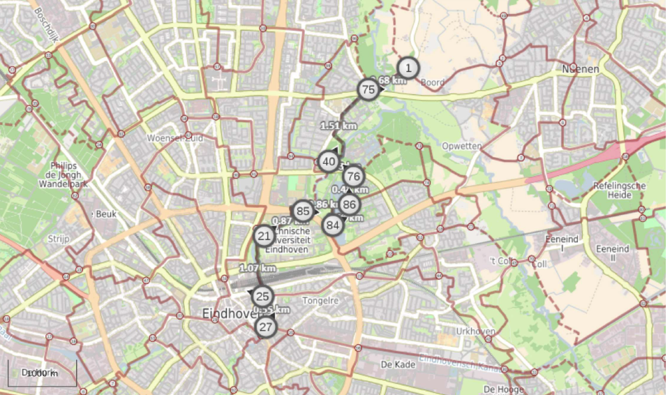
After the TU/E campus it took me several outings to figure out how to connect with the next part of the route staying on unpaved road and single track trail . The VisitBrabant network shows its unrivaled quality in allowing for a route that includes much of the same natural environments while requiring only a bit more of paved surfaces. But given my specific trail(running)focus my version certainly makes for a better, wilder outing. Check out the enlargements below (or zoom in even further using the interactive maps in your other browser tabs):

The above detailed comparison shows that my version not only makes for more trail but also includes some extras:
- as we pass so close to the Berenkuil (Insulindeplein), Eindhoven’s freezone for graffiti artists, and one of the Europe’s hotspots for this art form, why not use the opportunity for a good look at some spectacular work.
- it sweeps through the Eckhart forest, one of those green spaces mostly only used by locals but surprisingly varied.
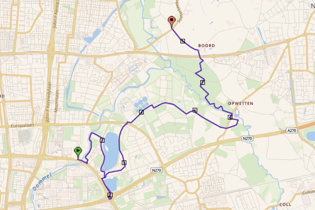
- it allows for a look at the Opwetten water mill
- it follows a trail lining the Kleine Dommel (not on any map, that is what exploration about…) and then veering inland to follow farmer footpaths to the very busy connection between Eindhoven and Nuenen. Along the short stretch of rural road after that, hooking up with the VisitBrabant route, it passes a gem for garden afficionados: the 6500 square meters of ‘Garden on the Boord‘ (only in Dutch, booking and entrance fee required.)
Lets move on to the next part of the Northern route. This time, I don’t insert a more detailed comparison of the four differences between the routes. I challenge you to come to grips with them yourself while looking at the interactive maps that are at your disposal in the other browser tabs:
- the first is in the different ways both trails find their way to Nederwetten village, mine staying close to the river, and then following a trail connection into the village, VisitBrabant following the road for the last half kilometer.
- the second is that my route sticks to the unpaved track lining the Wilhelmina canal for a bit after crossing the bridge before veering North on a trail not shown on any map, and joining the VisitBrabant route again near the village of Breugel. The latter got to that junction by taking a near traffic-free road from the bridge first and then an East-West trail following the Breugelse beek (brook). By the way: more route descriptions based on the above mentioned trail-friendly feature of all canals in the Eindhoven region – for large stretches, one of their banks has an unpaved footpath – are in the making.
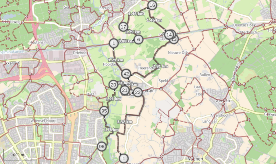
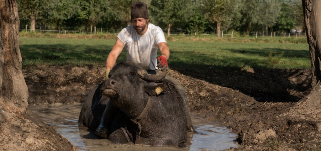
The fields where both routes meet are home to a family herd of 80 water buffalo, a sight to behold! Normally out in the fields, year round, after 11ish AM. It honestly blew my mind coming across them one tropical summer day last August.
- from the buffalos onward both routes are identical until recrossing the canal when mine follows a trail to the East of the road before rejoining the VisitBrabant route again opposite the easy to miss Hooidonk water mill. The trail is largely just for the surface underfoot but does have one real bonus: it passes a field with two Belgian draft horses (in proper Dutch called knollen), which, again, are a sight to behold! And when you have a look at the water mill, make sure to continue another 50 meters on to an unexpected bit of catholic heritage: a small chapel where formerly a nunnery for women from noble families existed, made famous by a miracle in the 12th century (and later infamous, by the lavish lifestyle of its inhabitants). The small park surrounding it has a way of the cross by Dutch sculptor Piet Schoenmakers.

- the last difference is when the routes cross the Dommel on a footbridge next to the 14th century clock tower of the old Nederwetten church, and mine sticks to the single track lining the Dommel bank while the VisitBrabant one follows a more inland footpath. Both make for a nice run/walk.
On to the last part of this Dommel exploration. Same story: my version has a couple of slight deviations, all making for more trail and/or less backtracking on paths taken earlier on the way North. The most noteworthy of these is that my route allows you to have a good look at the Eckhartdal estate, and its ‘castle’, now an institution for the mentally disabled (since 1938). It also takes as much of the Western bank of the Dommel as possible, which allows you to have a look at an art work in memory of the Woensel water mill that used to exist here but was demolished when the campus was build (of the 20 water mills that once operated in the Dommel watershed, my route has thus taken you along four).
Which brings us back to the start of this exploration of what is an exceptional ‘urban’ trail. I set off following the VisitBrabant suggestions, and then, with a more grounded feel for the landscape, looked at the interactive map for possible alternatives that would give me more unpaved, and checked out trails not on any map that looked promising. Some of those were dead ends, others proved great connections. Your preferred focus may differ from mine and your variation will thus turn out differently. Let me know what you come up with!
Just for the fun of it, some mesmerizing Ukrainian beat for desert:

2 thoughts on “exploring the Dommel valley”